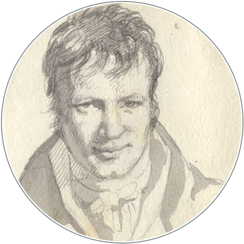
Alexander von Humboldt’s Search for the Casiquiare Canal:
Movements, Measurements, Maps
DOI:
https://doi.org/10.18443/298Schlagworte:
America journey; Cartography; Knowledge and movement; Casquiare CanalAbstract
Abstract
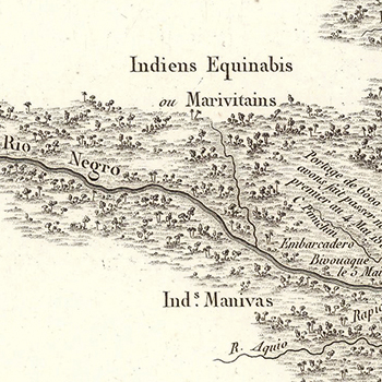
Though Humboldt’s travels to the Americas have been analyzed from a wide range of viewpoints, there are specific aspects that still await further investigation. Little is written about Humboldt in the field, specifically how he moved between different locations and simultaneously measured and mapped places and phenomena. The aim of this article is to discuss the triad movement-measure-ment-map that led to the development of specific practices of knowledge building on the move. Humboldt’s search for the connections between the watersheds of the Orinoco and the Amazon rivers and the resulting maps and drawings are used as an example to point out his cartographic impulse in his quest to understand and explain the physical world.
Zusammenfassung
Obwohl Humboldts Reisen nach Amerika unter ver-schiedenen Gesichtspunkten analysiert wurden, gibt es bestimmte Aspekte, die noch weiter untersucht werden müssen. Wenig ist jedoch über Humboldt im Feld geschrieben, insbesondere darüber, wie er sich zwischen verschiedenen Orten bewegte und gleichzeitig Lokalitäten und Phänomene maß und kartierte. Das Ziel dieses Artikels ist es, die Triade Bewegung-Messung-Landkarte zu diskutieren, die zur Entwicklung spezifischer Praktiken des „Wissenschaffens“ in Bewegung führte. Humboldts Suche nach den Verbindungen zwischen den Wassereinzugsgebieten des Orinoco und des Amazo-nasflusses sowie die daraus resultierenden Karten und Zeichnungen dienen als Beispiel, um seinen kartografischen Impuls bei seinem Bestreben, die physische Welt zu verstehen und zu erklären, hervorzuheben.
Resumen
Aunque los viajes de Humboldt a las Américas han sido analizados desde una amplia gama de puntos de vista, hay aspectos específicos que aún esperan una mayor investigación. Poco se escribe sobre Humboldt en el campo, específicamente cómo se movió entre diferentes lugares y simultáneamente midió y cartografió lugares y fenómenos. El objetivo de este artículo es discutir la tríada movimien-to-medición-mapa que condujo al desarrollo de prácticas específicas de construcción de conocimiento en movimiento. La investigación de Humboldt de las conexiones entre las cuencas hidrográficas del Orinoco y del Amazonas y los mapas y dibujos resultantes se utiliza como un ejemplo para señalar su impulso cartográfico en su búsqueda para comprender y explicar el mundo físico.
Downloads
Veröffentlicht
Zitationsvorschlag
Ausgabe
Rubrik
Lizenz
Copyright (c) 2020 Jorn Seemann

Dieses Werk steht unter der Lizenz Creative Commons Namensnennung - Nicht-kommerziell 4.0 International.
Die Rechte der eingesandten Artikel bleiben bei den Autoren und werden unter einer Creative Commons-Lizenz (CC BY-NC 4.0) veröffentlicht. Alle bei HiN publizierenden Autorinnen und Autoren akzeptieren dieses Lizenzmodell.
Die Autorinnen und Autoren tragen die Verantwortung für das Einwerben der Bildrechte.
Die Rechte am Layout und Design der Zeitschrift sind nicht übertragbar und können nicht ohne vorherige Zustimmung von HiN in anderen Publikationen weiterverwendet werden.